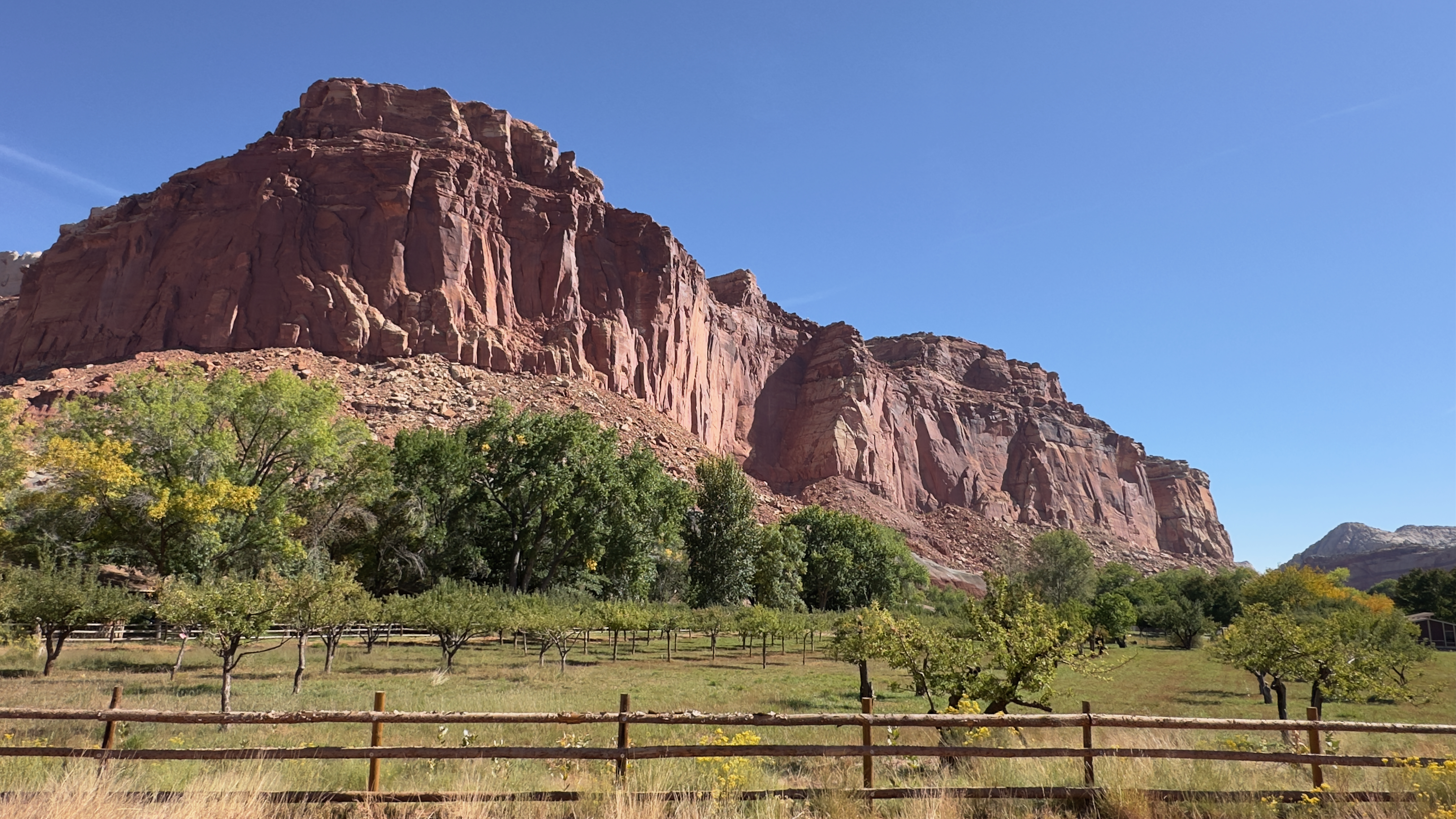
Dark Sky Coffee got our morning going in Torrey, Utah as we headed east on state route 24 with our first stop at Capitol Reef National Park. We entered the park and first visited Panorama Point and Goosenecks Overlook. Both vistas allowed for great views of the sandstone cliffs to the north and a canyon carved by the Sulphur Creek to the south.


The Visitor Center was just a bit down the road at the beginning of the park's scenic drive. We popped in to learn more about the park. Nearby was Fruita, a community whose first resident may have been an 1879 squatter by the name of Franklin Young. The first landholder of record was Nels Johnson. Others soon followed, and the community that sprang up became known as Junction. Mail was delivered to a central Fremont Cottonwood tree, known as the "Mail Tree," which still stands in the picnic area today. The area still has fruit trees descended from the originals planted nearly 140 years ago. Driving down the 7.9-mile scenic drive afforded amazing viewpoints of the park's geology including sandstone cliffs, deep red shale, yellowish-gray Shinarump sediments containing uranium, and a white Navajo Formation which stands over 1400-feet tall.


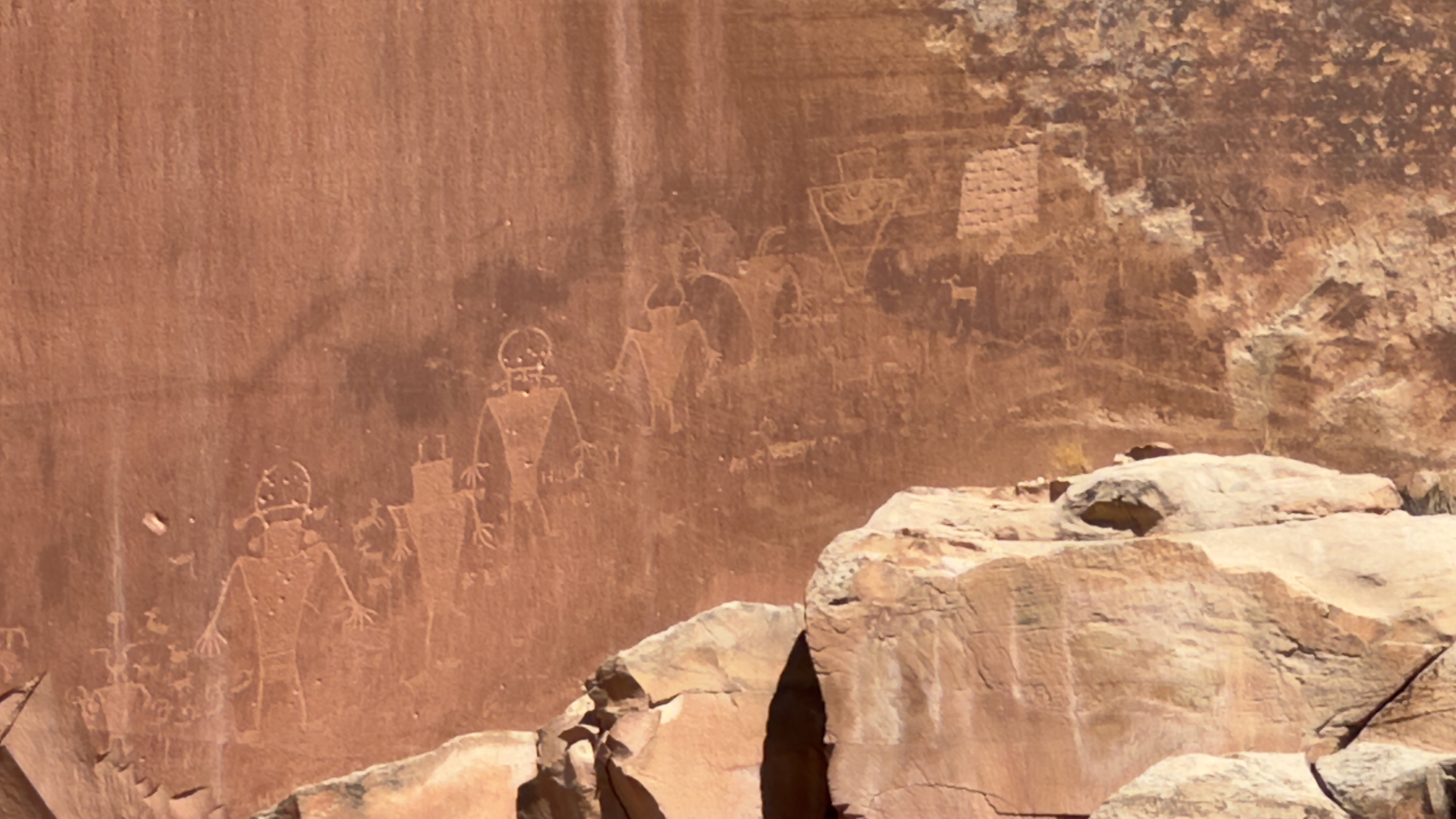
As we left the park, we came across the Fremont Culture petroglyphs. The figures cover several rock panels and the clarity of images was astonishing.


After grabbing a quick, on-the-road lunch in Hanksville, we turned north towards I-70.

We had a ticketed entry pass for Arches National Park that started at 3:00, and we arrived about 20 minutes later. After climbing through the mountain's switchbacks, we stopped at the Park Avenue Viewpoint, the Courthouse Towers, and Balanced Rock. Balanced Rock stands 128 feet tall and is an optical illusion. This formation isn't balanced at all, but rather the Entrada Sandstone sits attached to its eroding pedestal of Dewey Bridge mudstone. The North and South Windows were easily viewed from the parking area, but the hikes to both were in direct sunlight and with a temperature of nearly 90, we pressed along to another arch instead.


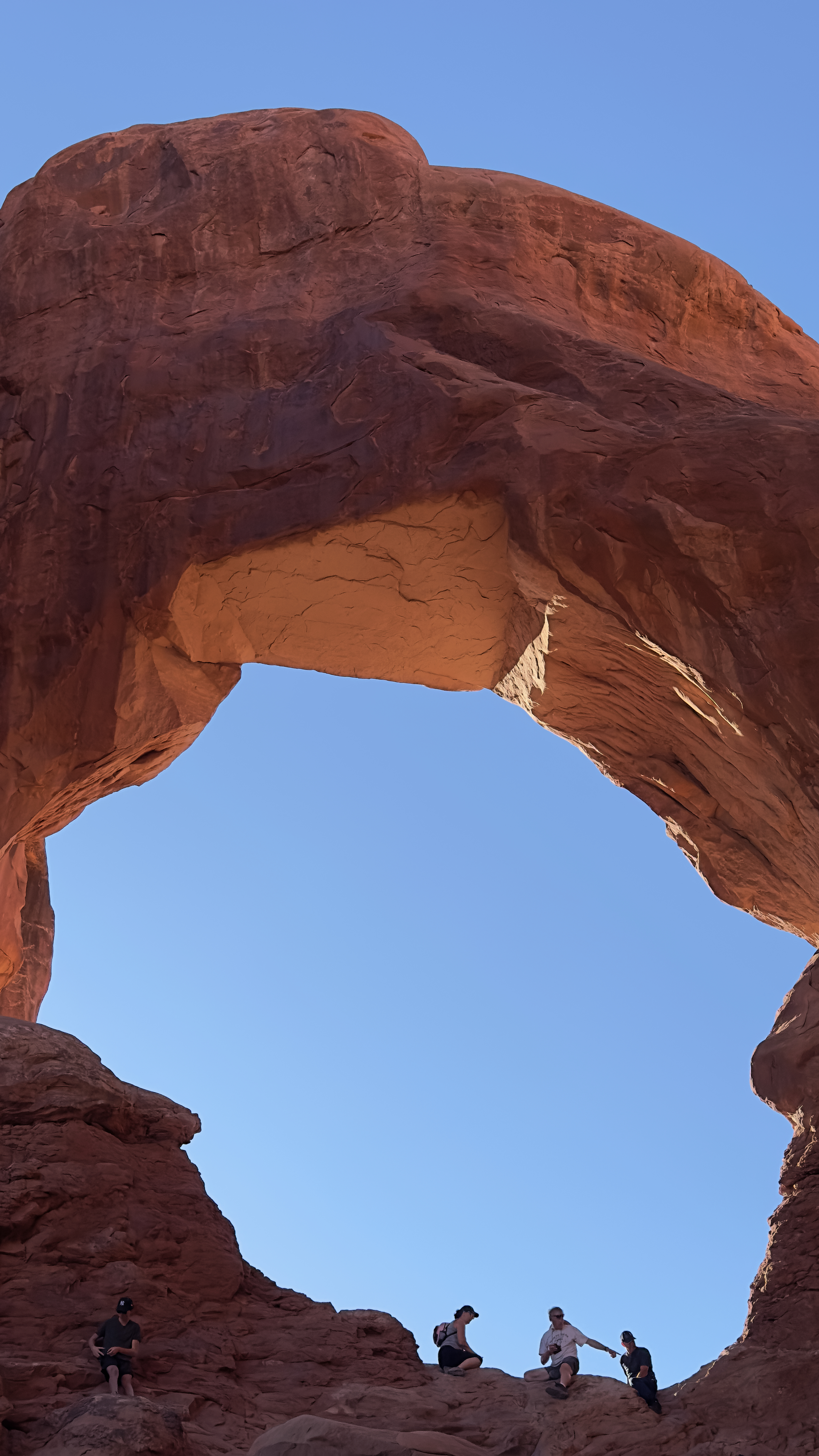
Also in the Windows Section of the park is the Double Arch. This was a short hike that was mostly shaded so off I went over the trail. Double Arch is both the tallest and second-longest in the park. Facing west, it allowed light from the sun to wash through. It takes its name because of it consists of two arches that share the same stone as a foundation for both of their outer legs. The arch was formed by downward water erosion from atop the sandstone, rather than from side-to-side water erosion. Once under it, I just had to take a picture from my back looking up. I was really glad I did this hike; it was a moving experience to be inside the formation.


The most famous arch in the park is Delicate Arch, a free-standing arch with a light opening beneath it of 46 feet high and 32 feet wide. The hike to get there is pretty substantial, and with sunset approaching it was very busy. Instead, we drove to the viewpoint to get shots of this amazing arch.


On the way back to the main drive, the sun was reflecting nicely off a sandstone cliff with a spot of color from yellow flowers and the flowing water of Salt Valley Wash.


As the sun began to set, we stopped at Balanced Rock. The reflective orange light was incredible!


Before leaving Arches, we stopped at the La Sal Mountains Viewpoint to watch the full (Harvest) moon rise from behind the distant mountains.


We found an amazing Italian restaurant and enjoyed old-fashioned/Old World pizza. Tomorrow, we leave Utah and enter Colorado.

No comments:
Post a Comment