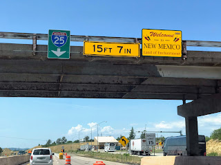
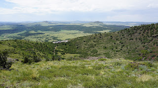
We awoke to a hot air balloon ascending outside our hotel window, which was quite nice to see. After a hotel breakfast, we faced a long driving day as we had to drive across parts of 4 states. Heading down I-25, we paralleled the southern part of the Rockies, but they soon got smaller in size and then became mesas and buttes as we entered southern Colorado. We took a break in Trinidad as our Roadside America app pointed us to the "Canary in the Coal Mine Monument" in downtown. It honors the "thankless" canaries that helped ensure miners were alerted to the presence of carbon monoxide. Jason drove us around the town a bit and we soon found ourselves going up a very steep county road full of boulders, potholes, and no guardrails. We were all shaken, not stirred. At the top is Simpson's Rest, an overlook of the town which includes the final resting place of pioneer George S. Simpson. The grave marker has unfortunately been very desecrated so there are no words or inscriptions left, but the sandstone bluff offers great views of Trinidad, Fisher's Peak (the mesa to the south), and the Trinidad electric sign which is still lit nightly.
Once we scampered back down the road, we made our way south to Raton, New Mexico. We grabbed lunch at Pappa's Sweet Shop, which used to be the candy/sweet store in town, but has since morphed into a great local restaurant. Near the historic downtown, we spotted the Raton Public Service Company's power plant and had to stop to look in the windows. Just like Conway, Raton's electric is municipally owned and provided by the PSC. Even though the plant stopped producing power in 2006 (the coal supply dried up), it was a neat building to see. We made one more unplanned stop near Raton: Sugarite Canyon State Park. While at lunch, we learned that the local coal mine and town in Sugarite Canyon still had ruins you could see. We stopped at the visitor center, but learned that all the ruins are on a hike in the area and we just didn't have time to do this. Another time, perhaps.
Our next stop was a short drive away: Capulin Volcano National Monument. It is a well-preserved, relatively young (58,000 to 62,000 years old), dormant symmetrical cinder cone volcano that rises steeply from the surrounding grassland plains to an elevation of 8,182 feet above sea level. The irregular rim of the crater is about a mile in circumference and the crater about 400 feet deep. We drove up the volcano to the parking area and then hiked up (and I mean up) to the summit where we could see out across the prairie to Kansas, Oklahoma, Texas, New Mexico, and Colorado. The crater is full of green plants, but under their leaves are ancient volcanic rock. It was a neat stop and one I'm glad we made, but the heat and biting gnats were distractions. I'd love to go back for one of their star viewings as this area is apparently known for having one of the darkest skies in the country (excellent for star viewing).
We still had many miles to cover so off we went. Texas and the Central Time Zone were soon whizzing by our windows and the mesas gave way to the flat agricultural fields that I've often seen from the air: the circular patches of green in otherwise desert-looking land. We stopped for dinner in Dumas, TX (yes, there is a disagreement between this Dumas and the Arkansas Dumas over the origination of a specific song which mentions the town name) and then continued toward western Oklahoma. We finally arrived at our hotel in Elk City at about 10:00 pm which is far later than we had originally hoped, but we had an excellent day yet again! One more push and we'll be in our own beds soon.


No comments:
Post a Comment