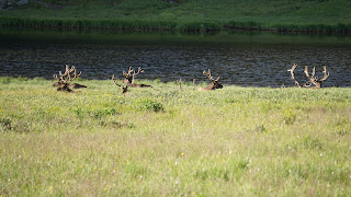
The electronic sign indicated the parking at Bear Lake was full, but we felt lucky and pushed on. Sure enough, we snagged a parking space (someone happened to pull out when we pulled in) and we were soon on the trail. It's a short, flat hike around this beautiful subalpine lake which is surrounded by spruce, fir, lodgepole pine and aspen. The wind was howling in from the west (up and over the mountain) so the lake was choppy on one side and calm on the other. Along the way we met some friendly chipmunks and ground squirrels and way up on one of the hills, 2 elk.
We wanted to do one more hike and the friendly ranger suggested the kids would like Alberta Falls. He also gave us a hint that we could hike to it from Bear Lake (mostly downhill) then go to the Glacier Gorge trailhead (downhill still) where we could pick up the shuttle bus back to Bear Lake. Off we trekked into the woods. It was a glorious morning with sunshine, a warm temperature, and gentle breeze which made the cottonwood leaves shimmer. We were soon treated to an amazing waterfall with lots of places to sit and enjoy it. The fall is 30-feet in height and runs down a gorge on Glacier Creek. It was named after Alberta Sprague one of the original settlers in the Estes Park area. Her husband, Abner, became the first visitor to pay an entrance fee to the park in 1939.
It was time for lunch so we headed to Estes Park, with a brief stop at the main park visitor center. Estes Park is the Branson of the Rockies. It's full of quaint shops, touristy trinkets, and people everywhere. It's quite a stark contrast to the laid back nature of Grand Lake. After fighting traffic we found a great little pizza joint and refueled. It was time to head back across the park and scale the mighty Rockies one last time. The Many Parks and Rainbow Curve Overlooks were our first stops. Both it offered spectaular views of the eastern side of the park.
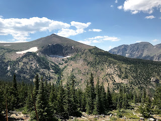
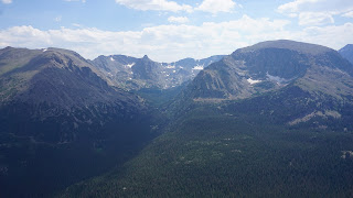
We continued west and soon arrived at the Forest Canyon Overlook. From here, some of the most iconic views of the park's mountains can be seen. The sun was very bright and my windbreaker was flapping in the breeze, but boy did we get to see some amazing peaks.
We soon reached the highest point on the road, 12,183 feet near the Tundra Communities Trailhead. This is all alpine tundra which means little vegetation, craggy rocks, little oxygen, and high winds. The sun's UV rays are also 25% stronger here. Jason and I were going to hike up to the Mushroom Rocks, but honestly, the altitude combined with our being tired anyway made us re-think our plan.
The Lava Cliffs Overlook was our next stop. The name is misleading as no lava actually flowed here, but volcanic cast off did land here thousands of years ago. As the rock face eroded away, the layers of volcanic debris could then be seen. This area also still has snowpack which some of our fellow visitors decided meant they could go around the fence, ignore the "stay off" sign, trample down the tundra, and go out on the snow.
Our next stop was the Gore Ridge Overlook. On a clear day, you can see the Gore Mountains 60 miles southwest of here. Today was a little hazy, but still had some great views.
Milner Pass was our final stop on our way back to the cabin. This is where the Continental Divide crosses the road. Water here has a chance to flow to the Pacific or the Atlantic, depending on which side it falls on the Divide. Poudre Lake is here as well (where we saw the elk lounging this morning).
As we neared the park's western exit, we spotted the tell-tale sign of a wildlife sighting: cars pulled over on the shoulder. Sure enough, a moose was cooling herself in a creek just off the road.
We spent our final evening in Grand Lake and as we move on today, I'm happy to say this was the perfect spot to stay and enjoy the area. We'll definitely return!


No comments:
Post a Comment